
Flooding is a perennial, seemingly intractable, problem in Indonesia, with climate change a major cause. Wahyu Wilopo of Universitas Gadjah Mada and Dwita Sutjiningsih of Universitas Indonesia write about efforts to address the environmental disaster and mitigate the risks especially in regions of the country that are particularly vulnerable including the sinking capital, Jakarta.
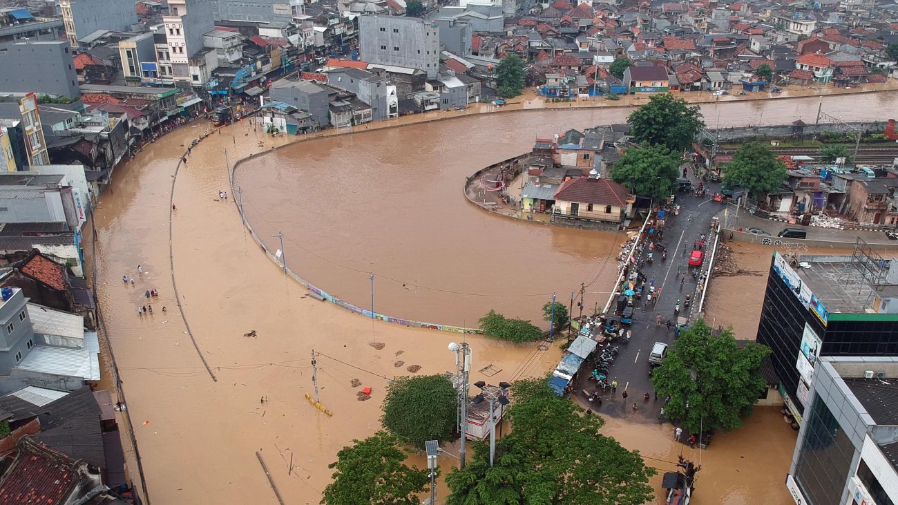
Water woe in Jakarta: Floods are one of Indonesia’s most frequent disasters, disrupting economic activities and causing the loss of lives and livelihoods (Credit: Hendra A Setyawan/Kompas/World Meteorological Organization)
Indonesia had almost 10,000 floods in the last decade, and flood incidents keep rising. To turn the tide, new cultural and infrastructural solutions may be needed. Around 100 million people live in flood-prone areas of the country (Jakarta is among the most vulnerable regions), totaling almost one-third of the national population. Relocating these people from disaster-prone areas to safe locations is a challenging proposition, but one of increasing importance.
Over the decade from 2010 to 2021, Indonesia experienced 9,894 floods, which killed 2,394 people, and prompted an average economic loss of 22.8 trillion Rupiah (US$1.5 billion). The incidence of floods is increasing year-on-year.
Floods are one of Indonesia’s most frequent disasters, disrupting economic activities, logistics flows, transportation, agricultural production, and other sectors, as well as causing tragic casualties. Indonesia’s vulnerability to flood stems partly from its complex geological makeup, arising from its position at the confluence of three of the world’s major tectonic plates: Eurasia, India-Australia and the Pacific. This led to the formation of a series of volcanoes from the west to east of Indonesia, making the country vulnerable to volcanic eruptions, as well as earthquakes, tsunamis, liquefaction, landslides, floods and extreme weather.
Data from Indonesia’s national Disaster Risk Index shows that in 2021, 324 districts and cities were classified as high flood risk, 69 were medium-risk and just three were low-risk. The increasing incidence of floods in Indonesia has been exacerbated by a combination of factors. Primarily they are the result of climate change, which causes coastal flooding through rising sea levels and high tides and also triggers alterations to rainfall patterns which have led to long periods of high intensity rainfall.
The runoff from this rainfall greatly exceeds the volume estimates that were originally used to design stormwater systems. Indonesia’s waterways are already under pressure from rapid urban expansion which has paved over the permeable surfaces that previously absorbed high-intensity rainfall. This is complicated by inundation in areas where land subsidence has occurred following massive groundwater extraction. This is a particular problem in Jakarta.
Human activities also exacerbate the effect of floods through land-use changes upstream, river sedimentation and deforestation, and insufficient or poorly functioning drainage channels in big cities such as the capital. The risks of flood disasters are heightened by growing numbers of people needing somewhere to live and moving into floodplain areas.
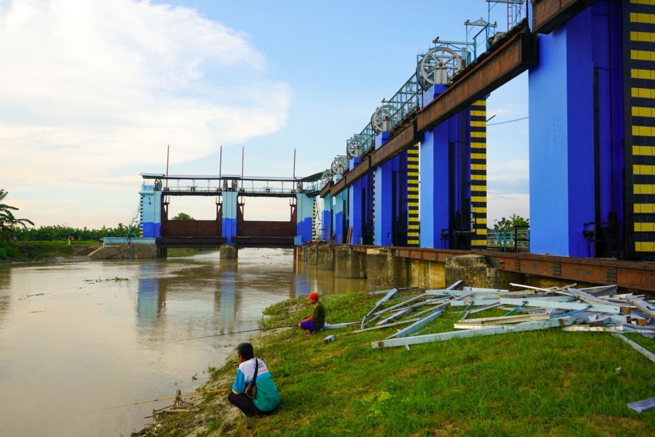
Managing and mitigating floods cannot be based on administrative boundaries, but must be coordinated within one river basin area, including upstream and downstream factors. Flood disaster mitigation can be carried out via two approaches: structural and non-structural. Structural solutions look at the physical factors which can minimize the impact of flooding, such as increasing the water channel's capacity, and reducing the speed of the water flow. Waterway capacity can be improved by widening the cross-section of the channel or river, deepening the riverbed and/or elevating the embankment, or developing a canal to break up the flow of the river.
Meanwhile, reducing the speed of water flow can be achieved by constructing reservoirs. Another structural solution to reduce flooding is building infiltration wells around new buildings to reduce surface runoff and increase groundwater recharge – this would require legislative changes to building permits.
Regional spatial planning is the first stage in disaster mitigation efforts. However, the response by different regional areas in Indonesia to include disaster information in preparing spatial plans has been patchy, with economic pressures among the reasons given for not following the plans.
Improving community preparedness in flood-prone areas can be conducted through education, socialization, training, developing flood standard-operating-procedures, developing maps of evacuation routes and safe points, and flood early warnings.
Flood early warning systems have been built in several areas in Indonesia, but not all of them function optimally for several reasons including: a low understanding of flood risk in the community; flood early warning and waterways monitoring systems that are not yet integrated; dissemination of flood information early warnings that have not been effective and efficient; lack of community capacity in responding to information and flood early warnings; lack of coordination between institutions and local governments in the delivery of flood early warnings to the public; and the use of technology is not yet optimal.
Disaster education is crucial to achieving community resilience in facing disasters, and should be introduced from an early age both in the family and school environment in order to turn knowledge into culture – a process that requires a long time and continuous effort.
Until now, however, Indonesia has made only limited efforts to require or guide disaster education in schools, both in class and in extracurriculars. It has sporadically implemented specific curricula at the local level. Disaster education, which provides knowledge about disasters and which implements anticipating and responding to disaster events into daily life, will in time lead to preparedness becoming the culture of the community, improving national resilience and mitigation in the face of increasing flood risks.
Jakarta’s severe flooding is happening more often and with more intensity. This is one of the many environmental challenges confronting the Indonesian capital that prompted the government of President Joko Widodo to announce in 2019 a plan to move the seat of the federal government to a new city to be named Nusantara that has yet to be built in the province of East Kalimantan on the island of Borneo. A key reason for Jakarta’s flooding problem is that the city is one of the fastest sinking cities in the world as a result of the extraction of groundwater, with some parts in the north subsiding by as much as 25 centimeters a year.
A new approach to addressing the floods might hold the key to moving forward. Flood control solutions are expensive, but the cost of inaction is far greater. Jakarta has faced large-scale severe flooding repeatedly over the past three decades, most recently in 2020. The 2007 floods were the worst to date, with inundation in some parts of the capital reaching five meters. Dozens died, thousands were displaced, and the city was paralyzed for days, suffering a damage bill that reached an estimated 5.2 trillion rupiah or US$400 million. And the rate of flooding is occurring more frequently in Jakarta and elsewhere.
Jakarta’s flood warning system makes use of water-level monitoring observed by an Automatic Water Level Recorder (AWLR) at 21 locations. Based on the reading, one of four flood alert statuses will be determined, ranging from “normal” to “dangerous”. The system is effective at regulating the distribution of flood discharge according to a set plan along each segment of the macro system. But flood inundation still happens. Ordinary natural events can turn into disasters. Without adopting localized, specific solutions tailored to the area, the damage will continue and could get worse.
Tailored flood-control solutions in Jakarta have been on the cards since 1973, originally planned for completion in 1985. The completion of Eastern Floodway was delayed almost by a quarter of a century as the government baulked at the enormous, ongoing budgetary support the project demanded. This was as high as five trillion rupiah or US$3.2 billion including the land acquisition.
The solution offered by Netherlands Engineering Consultants (NEDECO) was a sophisticated combination response to flooding that consisted of a macro-system divert of upstream flood water directly into the Java Sea (floodway), and a micro-drainage system of Jakarta, protected by the floodway. The draining system would consist of a gravity system and a polder system. The gravity system is designed for the area where the rainfall excess flows by gravity force into the drainage channel, while the polder system consists of a drainage channel, retention basin and pumphouse. All are specifically designed to account for Jakarta’s terrain, where elevation is lower than the mean sea level.
Jakarta has developed into a “megapolitan” city with a population of around 12 million, from a population in the 1940s of just 540,000 residents. There is less than ten percent of green open space left; the rest is built-up and impervious.
The water bodies that were originally swamps turned into areas which were ordained with various names starting with the word “Rawa” (swamp), for example Rawamangun, Rawasari, Rawabelong, Rawabuaya and so forth. Sites of runoff storage have been converted into residential blocks and industrial areas. The drainage system was not properly designed and implemented. They are subject to inundation due to local rainfall and worsen when combined with overflows from the river due to flooding from upstream or high tides which hamper the flow to the sea.
In some locations, this is exacerbated by the occurrence of land subsidence due to uncontrolled groundwater extraction. Flood overflows from rivers generally happen because of silting and narrowing of river channels, which is caused by illegal settlements encamping along the riverbank. These factors all feed into a greatly reduced capacity for Jakarta’s infrastructure to respond when flood-like conditions arise, such as the 2007 flood disaster.
That disaster saw a “perfect-storm” alignment of conditions – days of rainfall in the upper Ciliwung sending flooding to Jakarta, overflows and high tides in the Java Sea that hindered the flow of water to the open. In 2020, extreme rain – between 335mm and 377m of rainfall in one day – was the driving force. In the NEDECO document, daily rainfall of 210mm is projected to be exceeded only once in 100 years. And, at the time, the micro-drainage and polder systems had not been fully completed, preventing the flood-control solution functioning optimally.
The conventional approach to flood control is to back in hard structures, such as the solutions offered by NEDECO (floodway, drainage channels, polder systems), also known as gray infrastructure. This view assumes that the issue can be managed if the cause of the inundation can be identified. But solely embracing gray infrastructure cannot completely solve a problem as multi-dimensional as flood disasters.
Nature-based solutions – a combination of blue and green infrastructure – could be integrated alongside gray infrastructure to complement or enhance flood-control measures. It cannot replace gray infrastructure. Nature-based solutions utilize water elements, such as retention/detention basins and wetlands, and green elements, like parks, urban forest and green roofs, to build strong environmental resilience against extreme weather.
Non-structural changes have already been made to better protect Jakarta – laws and regulations that regulate matters such as water utilization, conservation and management of water-related disasters. Enforcement of the rules, however, is still very weak.
Standing in the way of successful reform is Indonesia’s rigid, sectoral system of state administration: It is difficult for authorities to access the budget to empower them to focus adequately on solving region-specific issues such as floods.
For example, the Ciliwung-Cisadane River Basin Authority is responsible for managing water resources – including program preparation, implementation of construction, operation and maintenance in the context of conservation and utilization of water resources. The authority also oversees the control of water in all kinds of bodies – rivers, coastal, reservoirs, urban drainage and more. The Authority also has jurisdiction over 13 trans-provincial rivers.
But there are many other parties with a say in Jakarta’s flood problems. Local governments manage drainage micro-systems across the capital, which is not always aligned in the realization of the required infrastructure development budget. The Watershed Forum, an independent group which works with local politicians to coordinate regulation of watersheds, also wants to provide input.
Overarching, unified collaboration among all the major players has yet to happen. The Basin Authority and local Greater Jakarta government struggle to work within the infrastructure development budget, while the Forum does not hold much power since it is a volunteer-based organization that is often more concerned with smaller-scale efforts (planting trees, cleaning up rubbish in rivers etc.).
Collaboration and a unified effort would help mobilize action on Jakarta’s flood problem, but so too would increased spending and a sense of urgency on infrastructure development. The issue is multifaceted and, after decades of lethargy and inaction, time is running short to prevent another disaster in the vein of 2007. The solutions are, it seems, out there – it is now just a matter of implementing them in time to prevent more unnecessary tragedy.
This article is an edited combination of two separate pieces written by the authors – Wahyu Wilopo of Universitas Gadjah Mada and Dwita Sutjiningsih of Universitas Indonesia – and published under Creative Commons with 360info.
Further reading:
Asia Global Institute
The University of Hong Kong
Room 326-348, Main Building
Pokfulam, Hong Kong
asiaglobalonline@hku.hk
+852 3917 1297
+852 3917 1277
©2026 AsiaGlobal Online Journal
All rights reserved. Terms of Use - Privacy Policy.
Opinions expressed in pieces published by AsiaGlobal Online reflect those of the authors and do not necessarily represent the views of AsiaGlobal Online or the Asia Global Institute.
The publication of AsiaGlobal Voices summaries does not indicate any endorsement by the Asia Global Institute or AsiaGlobal Online of the opinions expressed in them.

Check out here for more research and analysis from Asian perspectives.